A Tropical Storm Watch remains in effect for Southern Westchester, meaning tropical storm conditions are possible within the watch area, in this case within the next 24 to 36 hours.
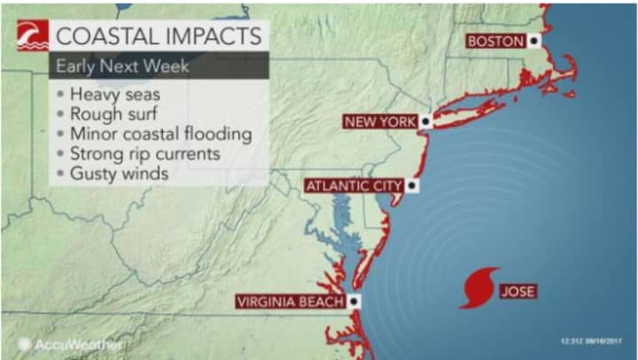
Coastal flood advisories have also been issued for Southern Westchester, from 9 a.m. to noon Tuesday and 6 p.m. Tuesday till 2 p.m. Wednesday.
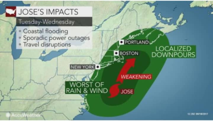
Heavy rain is expected for Westchester on Tuesday, with showers on Wednesday.
Showers are expected throughout the day Tuesday in Rockland, with morning showers Wednesday.
Rain should begin late Tuesday morning in Southern Westchester and become heavy after noontime, continuing on and off through the early evening.
Areas farther north in the Hudson Valley, including Putnam and Dutchess, will see mainly showers both Tuesday and possibly Wednesday as well.
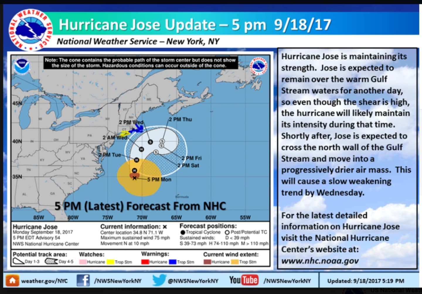
Jose is situated 440 miles south-southeast of New York City early Monday evening.
The Category 1 storm's maximum sustained winds remain near 75 mph with higher gusts. Little change in strength is forecast during the next 48 hours.
It will bring Nor'easter-type conditions to parts of the immediate coast along the I-95 corridor with soaking rain and gusty winds. Moderate coastal flooding is also possible.
The center of Jose is predicted to pass well offshore of the Delmarva peninsula Monday night and Tuesday, and pass well to the east of the New Jersey coast on Wednesday after a turn to the northeast is expected to occur on Tuesday night.
Check back to Daily Voice for updates.
Click here to follow Daily Voice Yorktown and receive free news updates.