
- Video Goes Viral: Train Blasts Hudson Valley Commuters With Snow
- How Much Did You Get? Hudson Valley Snowfall Accumulation Totals From Nor'easter
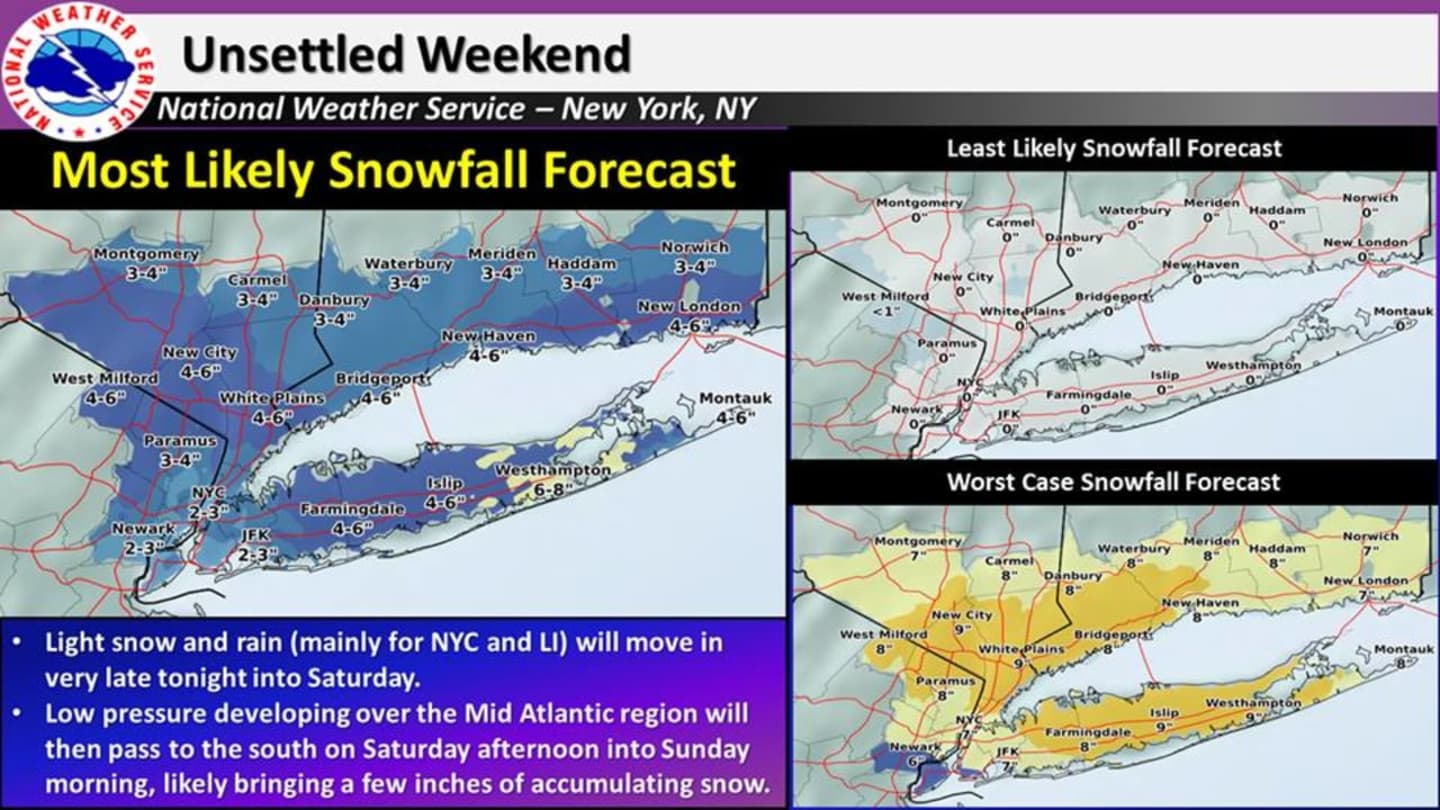
A new storm system that will arrive Saturday morning will have the opposite impact, with areas closer to the coast, especially south and east, now expected to see 6 inches or more of accumulation.
Dutchess, meanwhile, should be spared with less than an inch of accumulation expected.
Westchester, Putnam and Rockland, meanwhile, could see new two new rounds of accumulating snow for the final weekend of winter -- one Saturday morning into the early afternoon with an inch of accumulation possible, and the second Saturday evening into Saturday morning, with another 3 to 6 inches of accumulation possible.
Updated snowfall accumulation projections from the National Weather Service, released Friday, are in the chart above.
The chance of snow starts Saturday morning and continues through around 11 a.m, followed by the likelihood of a mix of rain and snow early in the afternoon. An inch or less of accumulation is expected before the high climbs to around 40.
Addition snowfall is likely Saturday night into Sunday, with the more significant snowfall coming. A "worst-case scenario" for accumulation (also in the chart above) is 9 inches of accumulation for Southern Westchester and Rockland.
Sunday will be partly sunny with a high near 40.
The first day of spring is Monday, March 20, will be sunny with a high in the low 40s.
Check back to Daily Voice for updates.
Click here to follow Daily Voice Yorktown and receive free news updates.